


Hurricane Helene spawned tempestuous seas.
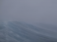
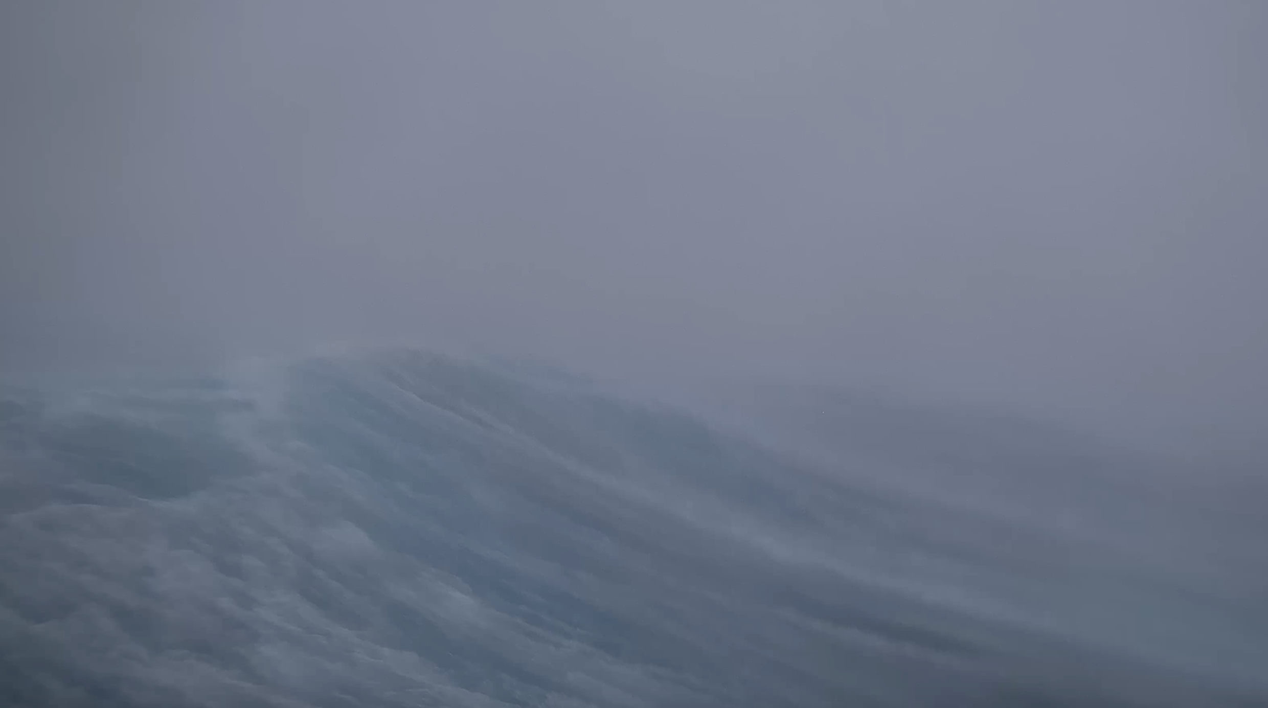
A collaboration between the U.S. National Oceanic and Atmospheric Administration (NOAA) and Saildrone, the company that builds innovative sailing drones, sent a robust robot into Hurricane Helene, the major hurricane that made landfall in Florida’s Big Bend region on Thursday night. Before hitting land with catastrophic storm surge and extreme 140 winds, a drone captured footage in the storm’s eyewall, home to some of its strongest winds.
The 30-second video below, beamed out from the drone, was captured on Sept. 26 at around 7:45 p.m ET (a short ad plays first). The average height of the tallest waves is around 30 feet, or 9 meters. Winds gusts knock around the drone, which is 23 feet long and 16 feet tall.
These robots are specifically designed for hurricanes, and meant to gather novel data about these cyclones, and how they evolve.
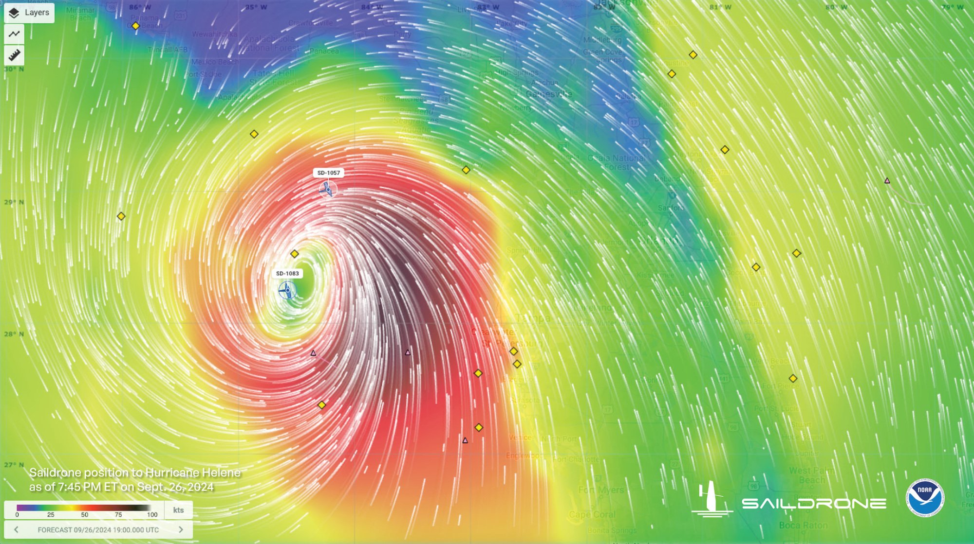
Credit: Saildrone / NOAA
NOAA employs Saildrones because they’ve proven excellent at directly gathering observations of ocean and atmospheric conditions on the sea surface. It’s there, where the oceans interact with the air, that hurricanes start to strengthen, sometimes rapidly.
Though a number of factors influence the formation of strong hurricanes (a lack of opposing winds that can break apart storms, moist or dry air, etc.), a vital influence is warm sea surface temperatures of over 80 degrees Fahrenheit (27 degrees Celsius). Warm oceans act as jet fuel for hurricanes, storm scientists explain. That’s because warmer oceans fuel tropical storms as more water naturally evaporates into the air, giving storms energy and moisture to intensify.
Hurricane Helene, for example, exploited record warm ocean temperatures to rapidly intensify into a monstrous storm. Today, Atlantic hurricanes are already twice as likely to develop from a milder storm into a major hurricane.


0 Comments